Today, Zwift opened the roads of Neokyo, the first expansion to Zwift’s latest world, Makuri Islands. Neokyo is an expansion of the Yumezi map, which was released back in May. The new roads, almost, double the size of the Makuri Islands. Zwifters will be able to ride and run between these two contrasting maps, which will be connected by a road through the rice fields.

This is the first expansion to the Makuri Islands which Zwift is priming to make into a second hub, possibly even rivaling Watopia. Unlike the Yumezi map, Neokyo has Vibrant colors, eye-popping neon lights, and flat and fast roads.
NEW ROUTES

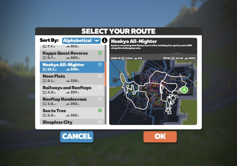
Neokyo expansion adds 8 new routes to the Makuri Islands. You will find these routes under the Makuri Islands tab in the main menu and select routes.

RAILWAYS AND ROOFTOPS: Take to the upper city where you will race along city railways and rooftops. Distance: 3.8 mi // 6.1 km, Elevation Gain: 226 ft // 68.9 m
ROOFTOP RENDEZVOUS: Feel the burn as you climb to the top of Neokyo, scaling rooftops and monorails on the way. Distance: 2.3 mi // 3.7 km, Elevation Gain: 184.7 ft // 56.3 m
NEON FLATS: Paint the town as you dominate three sprints along this flat route through the city. Distance: 9.1 mi // 14.7 km, Elevation Gain: 235.2 ft // 71.7 m
SPRINTER’S PLAYGROUND: Keep that heart racing as you complete four sprints in a single route. Distance: 7.6 mi // 12.3 km, Elevation Gain: 221 ft // 67.4 m
NEOKYO ALL-NIGHTER: Explore everything that Neokyo has to offer including four sprints and a KOM along this challenging route. Distance: 15.1 mi // 24.3 km, Elevation Gain: 548.9 ft // 167.3 m
SLEEPLESS CITY: Make your way through the heart of the city as you wind along this fast route. Distance: 5.9 mi // 9.5 km, Elevation Gain: 138.8 ft // 42.3 m
WANDERING FLATS: This long flatter route will take you from the scenic countryside to the bustling city. Distance: 15.5 mi // 25.0 km, Elevation Gain: 477.7 ft // 145.6 m
TEMPLES AND TOWERS: From downtown rooftops to mystical temples, grind to complete three KOM’s in a single route. Distance: 20.2 mi // 32.5 km, Elevation Gain: 1043.3 ft // 318 m
Did you ride the new maps? What do you think?


