

One of the benefits of smart trainers is their ability to simulate courses. Many athletes like to get familiar with courses before their race. Smart bike trainers can do that to a certain extent. In the next few weeks, I will be walking you through the different options and provide you with a how-to guide for each application.
Bkool, the Spanish company, don’t only make bike trainers, but they also have the Bkool Simulator – a virtual cycling software that can simulate real courses. It’s available for Mac OSX, Microsoft Windows, iOS, and Android.
Bkool simulator can simulate courses in three different ways:
- A map where you see a Google-styled map with your location and elevation profile
- A 3D world map. Depending on your location and GPX file you upload, Bkool can create a 3D styled virtual world of your course with a real-time weather.
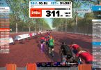
- Video Route. Bkool has a big library of real videos of different locations around the globe but you can also create one yourself and upload it to the Bkool application and ride the course. You will need a camera with GPS such as GoPro HERO 5/HERO 6 Black or one of Garmin’s VIRBs cameras.
You need to be a premium member, which costs $10/month. Bkool simulator is compatible with macOSX, iOS, Windows, and Android. It can connect to most smart trainers via ANT+ FE-C and control it to simulate routes or ERG mode workouts. Bluetooth connection is only available for Bkool trainers, Wahoo KICKR, Wahoo Snap, and CycleOps trainers.
You can try Bkool simulator free for 30 days
In this post, I will walk you through the first two options and create a 3D course.
GPX FILE
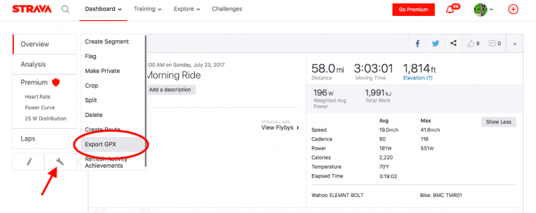
The first thing you need to get is a GPX file. If you use Strava, you can easily download the file directly from there and upload it to Bkool. Or you can use sites such as RideWithGPS to find different routes or a specific race course you want to ride and download the GPX file. However, for this guide, I will use a file from Strava.
To download a GPX file from STRAVA:
- Go to Strava.com and find the activity you wish to use and click on it to open the overview page.
- Under the left menu, click on the Actions button and then Export GPX file as you see in the screenshot below. The GPX file should start downloading:
- Go to Bkool.com and login to your account.
- After you login, click on SESSIONS on the top navigation menu.
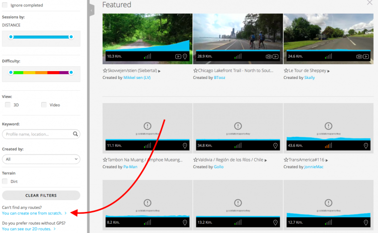
- You will see a list of featured courses. In the left column, under the clear filter button, you will see “Can’t find any routes? You can create one from scratch” Click on “You can create one from scratch”
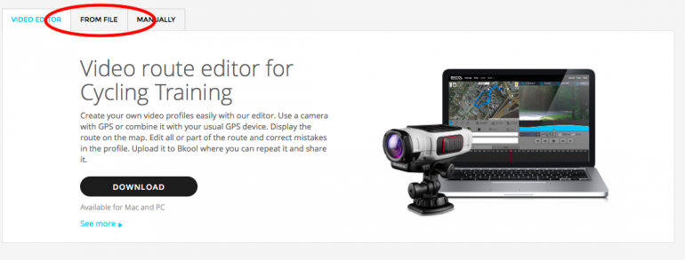
- You will be taken to the route editor screen. From there click on FROM FILE
- Click on SELECT A FILE. This is where you select the GPX file we downloaded from Strave. Click on IMPORT. On the next screen you will be asked to give the route a name and description. You can create a password if you want to make your route private.
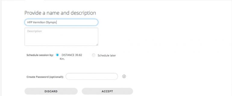
- Click on ACCEPT and you should get a message that the route is processing.
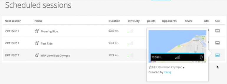
- After few minutes, go to SCHEDULED route on the top menu. You should see your route there. If you click on the little icon under “See”, a small pop-up menu should appear with a little map and your ride title. Click on the title and it should take you to the course detailed page.
- If the route is a candidate for 3D, you will see a GENERATE ROUTE IN 3D button. Click on that and you will get a message that the route is processing. It might take few hours to generate a 3D view of your route but you should get an email when it’s ready.
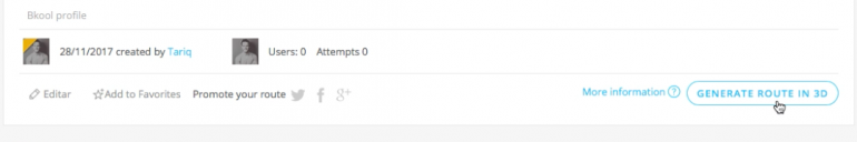 If you don’t see the GENERATE ROUTE IN 3D button, that means your route doesn’t qualify. But you can still ride it in 2D.The Bkool software takes the GPS data from your file and compares it to GPS data from NASA to create the 3D world courses.Some reasons why a 3D world might not be available for your route are:
– If the recorded altitude values from your file differ significantly from the NASA GPS data, it is considered corrupt and is rejected.
– If there is a climb or descent that exceeds a 20% incline/decline, the file is considered to be corrupt and is rejected.
– If the GPS data in the file is not clean (there stray signals that are clearly off course), there are long stoppages during the ride where the GPS coordinates are the same for multiple time stamps. Not using auto-pause and stopping for water, coffee, ice cream the file is rejected.If your route doesn’t qualify, you can still ride it using the Bkool simulator. It will be available as a map view and you will be able to ride it just like in real-world and your smart trainer will adjust slope to simulate the elevation profile.
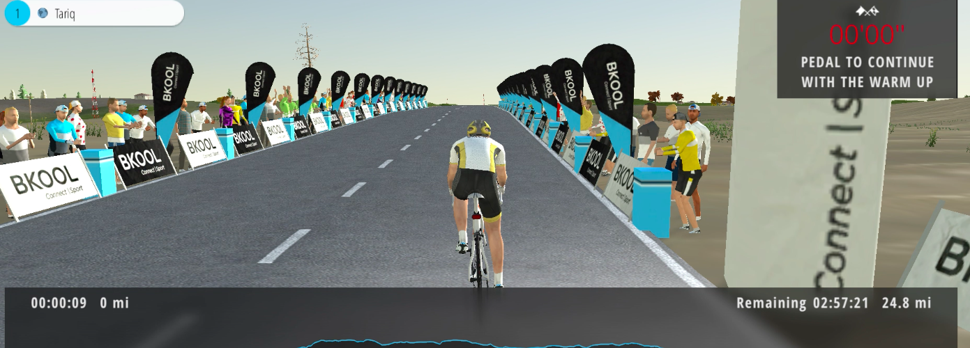
RIDING YOUR ROUTE
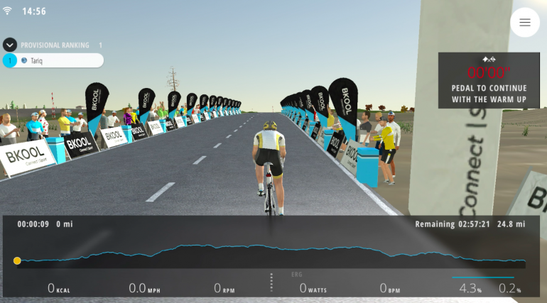
Now, let’s get to the fun part. After creating your route, open the Bkool simulator app on your mobile device or PC.
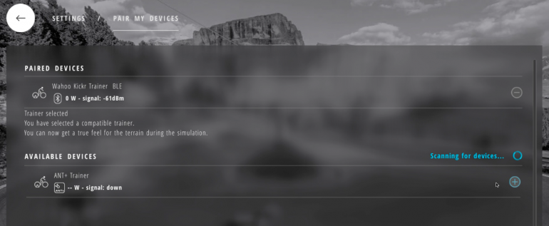
- The first thing you need to do is pair your smart trainer. The Bkool application will pair using ANT+ protocol with most smart trainers such as Wahoo KICKR, Tacx trainers, CycleOps, etc. Bluetooth is available only for Bkool smart trainers, Wahoo KICKR and CycleOps at this point. More trainers are being added.
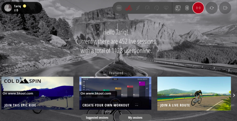
- Next, go under SESSIONS and find the route you just uploaded and click on it. Your session should start and you can start your ride.
You can find the route I created here to try out.
During your ride, you can use the following keys to control certain aspects:
- Use the LEFT and RIGHT keys or swipe left of right on your tablet to change view: 2D, 3D or video.
- Use UP and DOWN keys or swipe UP or DOWN on your tablet to show or hide the bottom panel.
- Use the SPACE key in 3D view to look behind you.
- Use the V key in 3D to change viewpoint.
This is it, if you decide to try it out, I would love to hear your thoughts. Please connect in the comment section and let me know what you think.


The feature is nice, but why this creator app doesnt take elevation data from gpx file? It calculates them from google maps what creates places with high fluctuations in slope. If I have gpx file with smooth elevation changes and slopes, this app will just overwrite them with google data.
Thank you for the inspirational YouTube video and these excellent instructions. BKOOL has allowed me to accomplish what I’ve been wanting for over 20 years. TACX came closest with the TTS program, but once they dropped StreetView integration on GPS rides, and essentially shut down, I have been figuratively stranded. BKOOL allows me to cycle using my TACX Fortius (also in native mode with VR and RLV), with a speed and cadence sensor, on an Android platform, connected to an HDTV. In parallel, I bought a used Kurt Kinetics trainer, added their inRide sensor and now that configuration also connects to an Android and PC device. Best of all, I can convert many of my actual GPS rides (and some virtual) into BKOOL as 3D virtual rides. My next challenge is to integrate real video. Thanks again …. Cam